
Getting to the Maule can be very confusing but the rewards are worth it. The Maule features warm water and 21 km of class 3-5 whitewater with a big water feel. Located in Chile’s 7th region the Maule is a good run to help break up the drive for kayakers in transit from Santiago to the Southern Rivers. An upstream dam near the Argentina border provides for fairly consistent summer flows.
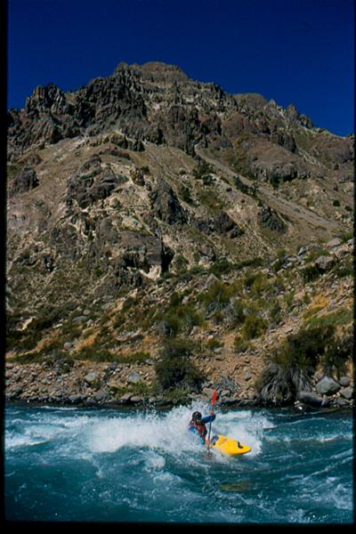
Franz Helfenstein on Rio Maule foto by John Mattson
The word Maule was derived from a mapuche word meaning
“lluvioso” or rainy which is somewhat strange as the Maule drainage is set in an incredibly arid desert environment. The Maule also has two other interesting feautres to note. First the Maule forms the divisional line between the clear waters of Southern Chile and the silty (on non dammed) rivers found to the North. Secondly the Maule valley has the distinction of being the southern terminus of the both the Spanish and Inca empires. the proud and fierce native Mapuche warriors took a stand at the Maule and it was never to be crossed.
From the city of Talca turn east and drive up the Maule drainage. Do not be concerned if the riverbed becomes completely dry. This is from the upstream dams and dewatering for irrigation purposes. Continue driving upstream until you reach the police checkpoint in La Mina (approximately 100 km from Talca). Here you will need to present and probably leave your passport to continue upstream. Many kayakers have been stymied at this point due to poor paperwork on the vehicles, no passports, etc. Be polite and if asked say you want to visit the hot springs. A death occurred on the river a few years ago and the police might argue if you make it obvious you plan to boat.
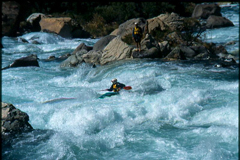
Surfing on the Maule foto by John Mattson
Once through the checkpoint the riverbed should once again have plenty of water so continue 1-2 km to the Banos de El Medano (925 meters above sea level). These hot springs serve as the takeout. To reach the put in, continue 21 km to the swinging bridge which leads to some very marginal hot springs on the other side of the river. This bridge at 1525 meters above sea level is the normal upper put in. At higher flows above 2000 CFS most mortals will tuck their tail between their legs and move 2 km downstream to avoid this initial section of class 5+ thundering chaos. After the first 2 KM the river rhythm tapers off and opens up into wide open high speed wave trains with some great play. Three times throughout the run the river enters distinct canyons each of which contains serious whitewater. Like many kayak runs it just so happens that you do not see these canyon stretches from the vehicle while driving to the put-in. Depending on water levels some may choose to portage parts of these canyons none of which is more than a few hundred meters long.
Note 1: I once ran the Maule in early October on natural flow and it was excellent. The water up highs tarted out small but ice cold glacial tributaries entered constantly making the takeout volume substantial.
Note 2: A few km above the swinging bridge put in is a 100+ foot waterfall. Definitely worth the minimal effort to see this impressive site.
Note 3: Ben May and Nathan Sullivan report more intense whitewater above the falls but below the lake and the border crossing.
Note 4: Other great nearby rivers are The Ancoa, Achibueno, Melado