
This springtime gem is full on micro kayaking…Bring a good crew, bring you’re A game and expect to spend a long day scouting and setting safety. A full face mask and body armor are highly recommended. After finishing the first descent Ben May commented that if the Puesco and Nevados had an evil child it would be the Amargo. For hair boaters this may be Chile´s new classic run.
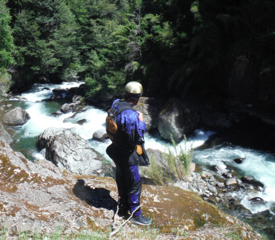
Ben May scouting the Upper Amargo
Directions: From Ruta 5 in Collipulli take paved road towards Curaco. The pavement ends at KM 45 and gravel roads continues into town of El Amargo km 56?. There is a good takeout in town at the confluence of the Renaico and the Río Amargo which also serves as an free and safe campsite.. (Renaico is also an excellent run: see separate description). To reach put incross back over bridge coming into town and turn left and go 8 KM to put in at Puente Amargo.
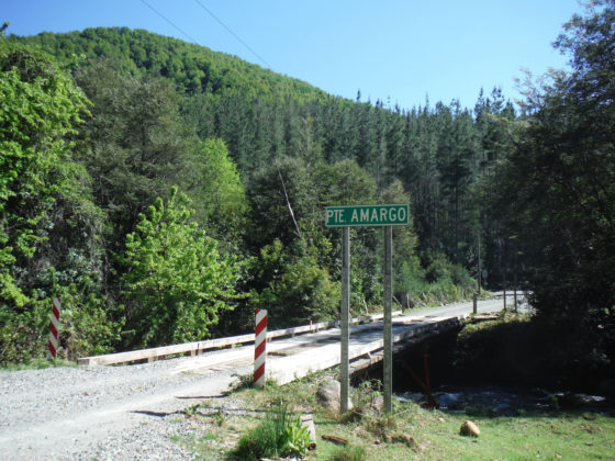
Put in bridge at Puente Amargo
At the put in the creek is very small but do not be fooled. The whitewater starts almost immediately and the small volume proves to be optimal.
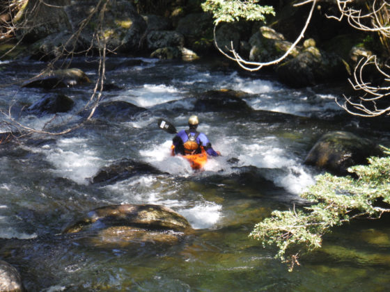
Whitewater at start of river
Very quickly the horizon line appears and the scouts start. For the first 1 km a good animal trail is on river left to facilitate scouting and portaging. When the river falls into a vertical walled canyon things become much more difficult and continue this way for 2.5 km to km 4.6 (the road has distance marks every 20 meters)…Here there is a house with a very good trail to the river. This would also serve as an alternative put in making the run class 3-4 from this point to takeout. Note at the crest of the road km 6.44 there is a turnout and one can walk down and be very high on the cliffs above the river. Peering down into the canyon from this point will give a feel as to what one can expect before committing to the run.
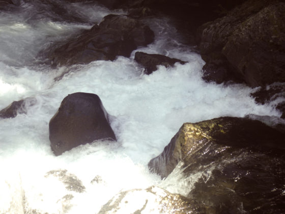
Fury of the upper canyon
Length 7.55 km
Put in elevation 697
Takeout elevation 390 m
Total drop 307 meters
Average gradient 41 m/km or 200 FPM with sections over 80 m/km
Class 5+
Flow put in 100
Flow takeout 300
Map Laguna Malleco G-051
GPS Put in Latitude -38.094005°
Longitude -71.806402°
GPS Take out Latitude -38.075891°
Longitude -71.872247°