An isolated tributary of the Upper Bio Bio watershed flowing of the Northside of both Volcan Longquimay and Volcan Tolhuaca. In local Mapadungun language Lolco means Earth Water….
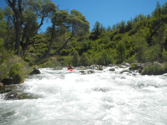
With a flow of around 500 CFS at takeout the Lolco provides an incredibly beautiful run through crystal clear watershed… Old growth Coigüe trees and the occasional Araucaria add to its surreal appeal. At put in the river is small but soon doubles with the combined flow of Rio de la Nalcas coming off the flanks of Volcan Tolhuaca.
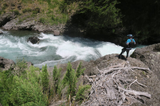
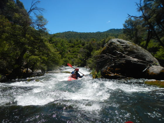
The run is for the most part easy class 3 but there is one one class 4+ canyon about 4 km into the run which features one very distinct drop. On our first descent run in December 2016 this rapid caught us off guard but luckily caused no major problems.
Rio Lolco below Nalcas confluence
The added bonus of this run is the incredible drive to and from the river up and over the Longquimay Volcano with stunning views of lava fields and surrounding peaks of Crater Navidad, Tolhuaca, Antuco and Copihue…From Ruta 5 take the road to Curacautin (from Lautaro if coming from South or from Victoria if coming from North) Continue up to Malalcahuello then follow signs towards Corralco Ski area…Just after the Conaf National Park entrance take the first right hand turn and here zero out the odometer… From this point it is 24.6 km until you come to Puente Lolco…..You can put in here but we chose to continue another 4 km where it was a short hike down to the river. From our put in it was 6 km to takeout at a logging bridge that goes to Villacura. A locked gate on the main road prevented us from riving down to the river but it was only a 10 minute hike with our boats back up to the road and to where we left a vehicle…
-FIelds Marshall
Note: an optional way in or out of the drainage is via the upper Bio Bio water shed and towns of Lonquimay and Nitro…
John Govi and I put-in not quite a kilometer north of the pine tree farm/forest that is evident on satellite imagery. This was a couple kilometers upstream of the Nalcas confluence, where a small creek meets the river. Approximate coordinates: -38.234000 S -71.458000 W. There are a few potential put-ins in this area. None are obvious. Most involve crossing cow pastures rife with horseflies.
We took out on the reservoir a couple kilometers north of the village of Lolco, at a pasture gate just before the road starts climbing above the water.
The run is enjoyable boulder garden class III with a few class IVs. The very distinct drop that Fields mentions above comes below the Nalcas confluence, immediately after two class IV rapids. At our medium water level, there was a good scout eddy and portage route on river right.

-Tyler Williams
Put in elevation 890 meters
Take out elevation 760 meters
Trip length 6 KM
Average gradient 22 meters per kilometer or 110 FPM
Rio Lolco at put in
Other rivers in area include
- Bio Bio
- Llanquen
- Cautin
- Dillo
- Truful Truful
- Ralco
- Blanco del Sur
- Captren
Topo map is titled Lolco G-053
GPS coordinates takeout -38.15S, -71.42
Put in -38.21S, -71.455


In a major win for river rights in Latin America, Chilean energy company Endesa has announced that it has relinquished all claims to the water on the Futaleuf , Puelo, Chillan, Bard n and Huech n rivers in Chile. That means that six hydroelectric projects, totaling 2,151 MW, have been scrapped.