
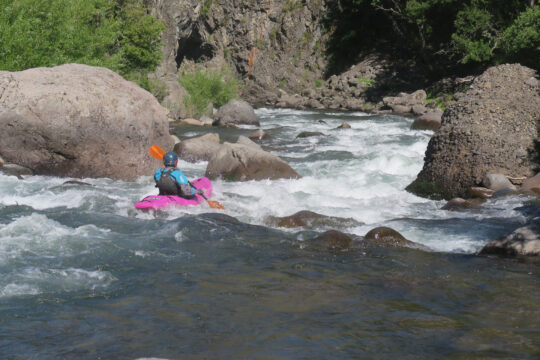
Very similar in character to the nearby Río Ralco, the Chalquilvin is the Lomín’s other major tributary. Its sustained gradient creates many boat-scoutable, pool-drop rapids in a tight, shallow gorge. Unfortunately, when the bridge collapsed over the Lomín, easy access to the Chaquilvin was lost. Now only die-hard boat hikers or horses make the journey to the put-in. If you make the effort, you will be rewarded with an excellent class IV run in a beautiful setting.
Refer to the Ralco description to find the take-out elevation 670 meters. From the collapsed bridge now serving as a ferry crossing, walk or hire horses to carry your boat 11 km upstream to an unnamed bridge that crosses the Chalquilvin at 870 meters elevation
-John Foss
The Lomin bridge that Foss refers to has been re-built, so access is no problem. It’s about 11 km from the bridge to the put-in. Turn right just past the police outpost and pass through some Arucauria trees before reaching the river. The put-in is at a road ford that, incidentally, is the route over to the Lolco valley, reportedly a full-on four-wheel-drive jeep path.
John Govi and I ran this on Christmas day, 2024. We had about 250-300 cfs. This was fine but 350-400 would probably be ideal. Beware of one sievey rapid towards the end of the run, where imposing cliff walls exist on river right. One can manage a portage on the left if desired. At the Lomin confluence, you must carry across a crumbling bluff on Lomin river left a short distance to the bridge.
-Tyler Williams
This class IV•IV+ run has average gradient of 18 mpk or 96 FPM and best run in spring with flows of 250 to 500 CFS
Topo maps are Curacautín • Lolco
Nearby Rivers include Ralco, Queuco. Lower Bio Bio, Laja, and Nuble